Hurricane Barry
Event Report: Hurricane Barry
On July 13, early afternoon, Hurricane Barry made landfall near Intracoastal City, LA, as a low end hurricane with sustained wind speed of 115 km/h. Barry had been upgraded to minimal hurricane status just 3 hours before landfall and quickly after coming ashore was downgraded back to a tropical storm. At the time of writing, the system is still in existence as a tropical depression with wind speed of 45 km/h. Barry’s storm surge component peaked around 1m lower than forecasted (levees in most locations in the area are high enough to protect against the originally forecasted surge) and consequently flooding from storm surge remained localised.
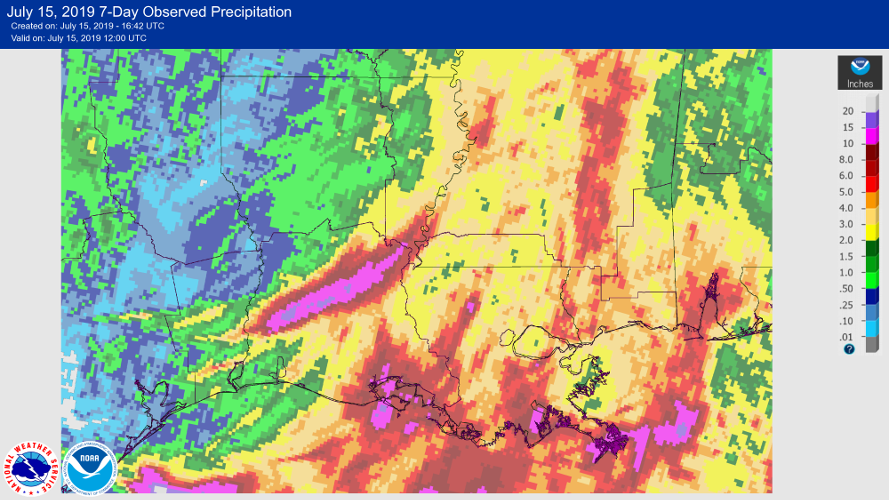
The biggest threat from Barry was the potential for very intense rain with associated inland flooding. This threat needs to be put into perspective, however, as during no time during its life cycle was Barry threatening to become an event comparable in extent or severity to Harvey in 2017. Though flash flooding is still a risk in many areas, the rain totals are now unlikely to come close to the predicted amounts. Nevertheless, the rains will extend the most prolonged flood on record across parts of the mid- and lower Mississippi River.
Barry was not expected to have a larger effect on the reinsurance industry. The meteorological development of the event and collection of first information about reported impacts confirm this assessment.
Barry is not expected to have an impact on the Solidum Funds.
The portfolio management team remains at your disposal for any additional questions.
Kind regards
The Solidum Management Team
Source: National Oceanic and Atmospheric Administration (NOAA)